FREE DELIVERY TODAY - Place your 1st order.

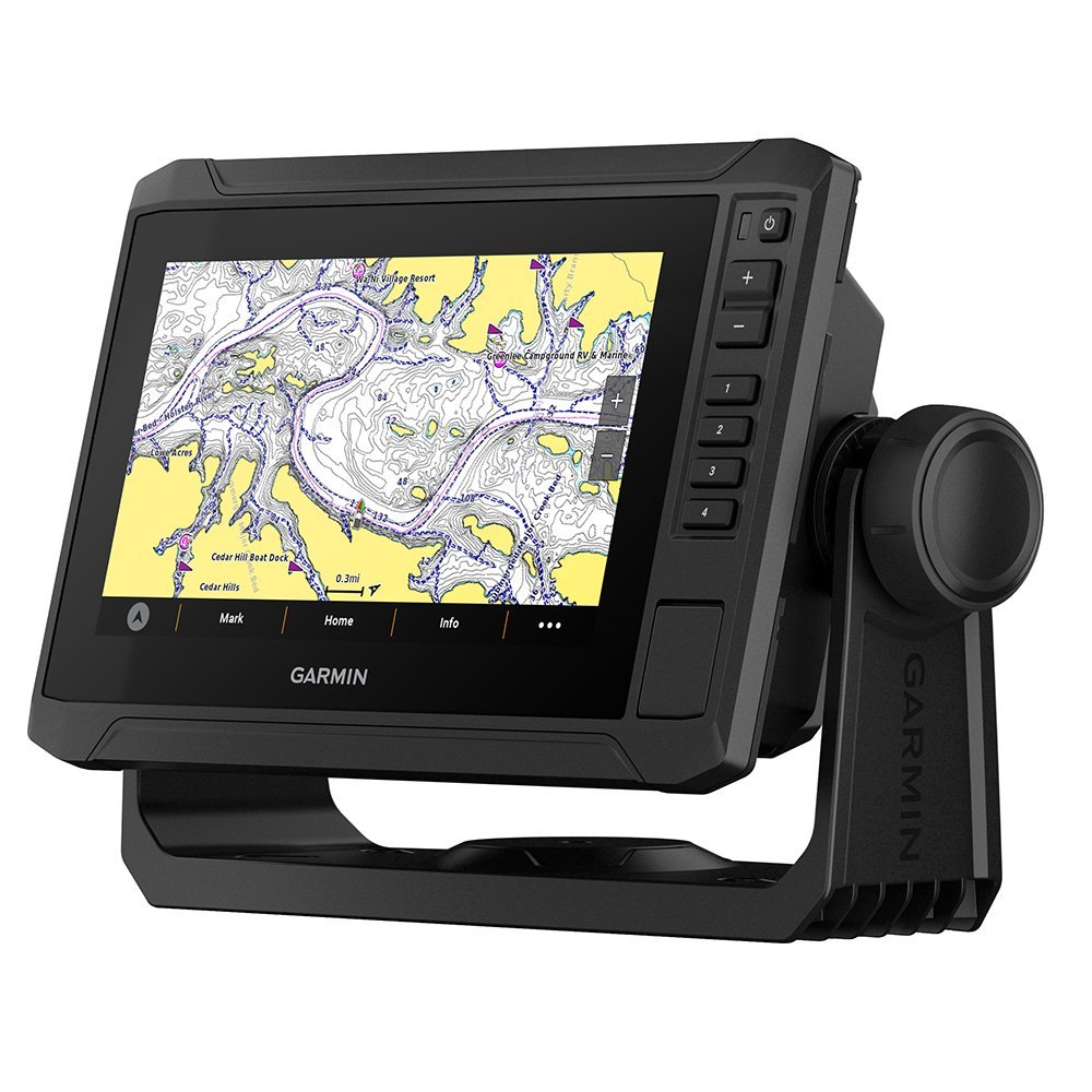
Garmin ECHOMAP UHD2 64sv 6″ Coastal Chartplotter
Products are almost sold out
available only:
10In Stock
Description
The Garmin ECHOMAP UHD2 64sv 6′ Coastal Chartplotter eliminates frustrating screen glare and tracking lag on coastal skiffs, bay fishing platforms, smaller center consoles, and specialized flats boats. Operating efficiently on a 9 to 18 Volts DC marine battery network, this automated fishfinder coordinates Ultra High-Definition sonar processing to replace low-resolution depth finders entirely. Anglers can navigate tricky tidal flats and coastal shallows safely, letting the internal GPS chartplotter map precise underwater terrain changes utilizing preloaded BlueChart g3 marine maps.
Featuring a compact 6.2-inch diagonal window running an 800 x 480 WVGA color multi-touch display with keyed assist, the intuitive interface ensures error-free menu adjustments during rough sea conditions. The built-in ClearVü and SideVü scanning modules track up to 1070 kHz performance bands, mapping structure and weed beds with incredible definition down to 2300 feet in traditional freshwater mode. Procuring this premium Taiwan-manufactured coastal navigator upgrades foredeck electronics via wireless unit-to-unit sonar sharing, backed by a comprehensive 1-Year limited manufacturer warranty plan.
Key Features of Garmin ECHOMAP UHD2 64sv
- Fishfinder GPS Chartplotter Combo Unit Layout merges high-definition scanning sonar, internal coastal mapping software, and wireless data routing into a singular compact helm terminal.
- WVGA Color Multi-Touch Display with Keyed Assist combines responsive touchscreen navigation menus with tactile physical button safety for seamless wet-weather adjustments.
- Sonar Power Rating 500 Watts RMS Output drives specialized transducer frequencies forcefully to provide excellent target separation down to deep bottom contours.
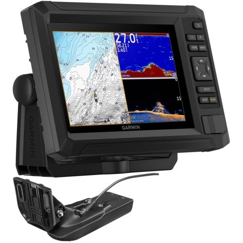
- Ultra High-Definition ClearVü Scanning Sonar tracks 800 kHz frequency performance bands to reveal sharp timber and rock pile structures directly beneath the hull floor.
- UHD SideVü High-Definition Scanning scans expansive lateral view zones up to 1070 kHz to track fish-holding habitats on either side of the vessel structure.
- Panoptix and LiveScope Network Compatibility permits immediate wireless connection to real-time live action sonar sweeps to monitor active lure tracking loops.
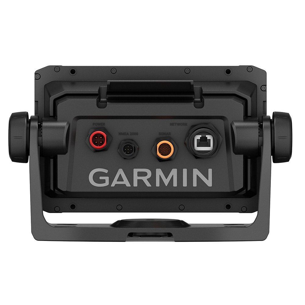
- NMEA 2000 Micro-C Connector System Matrix shares critical navigation data, compass headings, and digital engine gauges across the vessel network instantly.
- Wireless Unit-to-Unit Data Sharing protocols shares real-time sonar views and custom waypoint routes across separate compatible helm displays without running cables.
- IPX7 Waterproof Protection Architecture Housing shields inner computing boards from permanent damage when exposed to heavy deck washdowns or rain storms.
- Current Draw 1.5 Amps at 12V DC Input Loop limits electrical draw to a maximum of 18 Watts to preserve small skiff power banks.
In the Box
- 1x Garmin ECHOMAP UHD2 64sv Coastal Chartplotter Unit
- 1x Tilt-Swivel Quick-Release Mounting Gimbal Bracket
- 1x Flush Mount Gasket Pack with Deck Templates
- 1x Snap-On Protective Dashboard Sun Cover
- 1x Waterproof Power and Network Data Cable Pack with Installation Manual
Compact Helm Automation Optimizes Coastal Skiff Navigation
Designed for bay fishing platforms and specialized flats watercraft measuring 14 to 22 feet, this 6-inch coastal chartplotter delivers elite monitoring accuracy that protects vessel safety in moving currents. The rugged multi-touch layout coupled with a reliable 1-Year limited warranty program shields owners from unexpected system breakdowns and expensive replacement bills. Rinsing salt crust off the display face with fresh water after every trip maintains pristine structural finishes, protecting your pleasure marine investment for years of outdoor use.
Garmin ECHOMAP UHD2 64sv 6" Coastal Chartplotter Specs
| Brand | Garmin |
| Full Model SKU/Code | 010-02683-00 (ECHOMAP UHD2 64sv) |
| Country of Origin | Taiwan |
| Component Type | Fishfinder / GPS Chartplotter Combo Unit |
| Display Technology & Resolution | WVGA Color Multi-Touch Display with Keyed Assist / 800 x 480 |
| Screen Size | 6.2" Diagonal Window |
| Sonar Power Rating / Output Power | 500 Watts RMS |
| Traditional CHIRP Frequencies | 50/77/83/200 kHz (Low, Medium, and High CHIRP Support) |
| Scanning Sonar Technologies | Ultra High-Definition ClearVü, SideVü, and Traditional CHIRP |
| Scanning Sonar Frequencies | CHIRP ClearVü: 800 kHz; UHD ClearVü: 800 kHz; UHD SideVü: 1070 kHz |
| Live Sonar Compatibility | Panoptix and LiveScope Network Compatible (via Wireless Sharing) |
| Maximum Depth Capacity | 700 m / 2300 ft Traditional Freshwater (Dependent on Transducer) |
| Operating Voltage | 9 to 18 Volts DC |
| Data Networking Protocols | NMEA 2000, Wireless Connectivity (Unit-to-Unit Sonar/Waypoints) |
| Waterproof Rating | IPX7 Waterproof Protection Architecture |
| Maximum Current Draw | 1.5 Amps at 12V DC Input Loop (Max Power Draw: 18.0W) |
| Dry Weight | 0.8 kg / 1.8 lbs |
| Application | Coastal skiffs, bay fishing platforms, smaller center consoles, and specialized flats boats utilizing preloaded BlueChart g3 marine maps (14-22 ft hulls) |
You must be logged in to post a review.






Reviews
There are no reviews yet.