FREE DELIVERY TODAY - Place your 1st order.

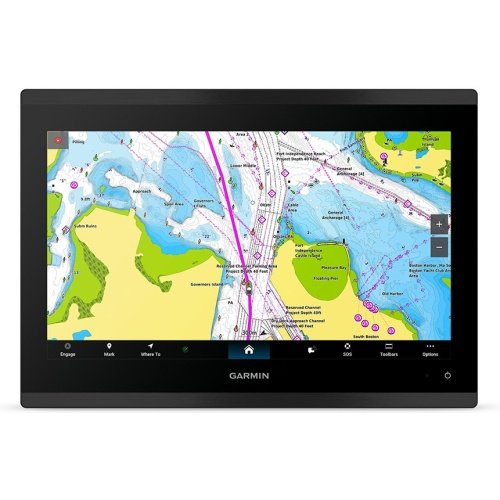
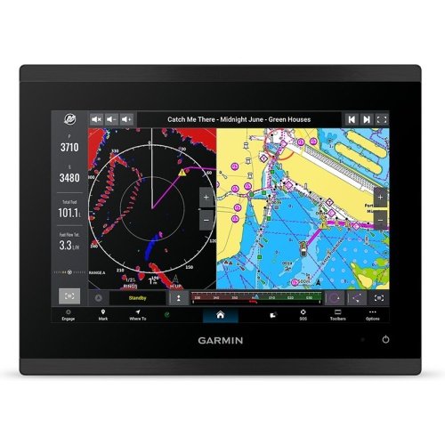
Garmin GPSMAP 8610 10″ Premium Touch Chartplotter
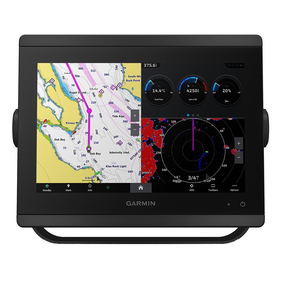
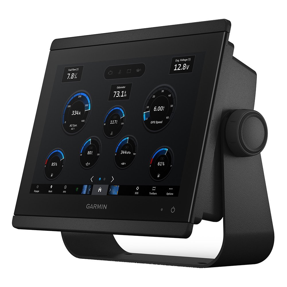
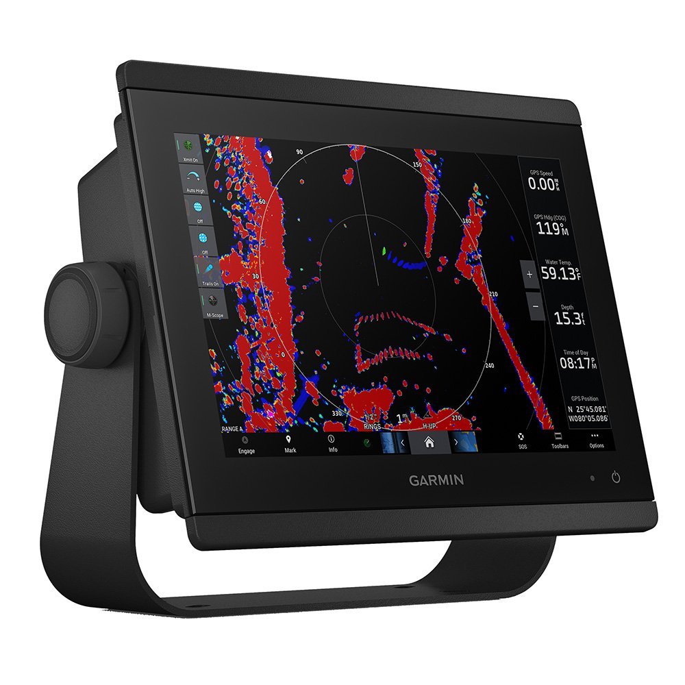
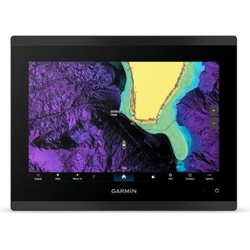
The Garmin GPSMAP 8610 10″ Premium Touch Chartplotter, from Garmin, comes with a 10.1″ Diagonal Window Display Surface screen, and has a dry weight of 2.4 kg / 5.2 lbs.
- Device Type: Premium Fixed-Mount Touchscreen Multi-Function Display (MFD).
- GNSS Systems Support: GPS, GLONASS, Galileo, QZSS.
- Interface Type: Capacitive Multi-Touch Control Display.
Products are almost sold out
available only:
8In Stock
Description
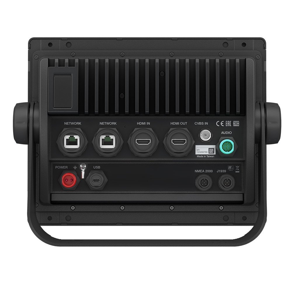
The Garmin GPSMAP 8610 is a 10.1-inch premium touch chartplotter with Full HD resolution, BlueChart g3 and LakeVü g3 core maps, and a 10Hz internal GNSS receiver supporting GPS, GLONASS, Galileo, and QZSS. NMEA 2000, NMEA 0183, J1939, Garmin Marine Network, WiFi, Bluetooth, and ANT+ provide a broad connected platform for offshore fishing boats and sports cruisers.
Key Features
- 10.1-inch Full HD IPS multi-touch screen – Provides a clear chart workspace for mid-size fishing boats and cruisers.
- 1920 x 1080 resolution – Shows detailed marine and inland mapping across the display.
- 10Hz internal GNSS receiver – Provides the stated high-rate positioning support for navigation and route tracking.
- BlueChart g3 and LakeVü g3 core maps – Provides preloaded coastal and inland chart data.
- Garmin Marine Network, NMEA 2000, NMEA 0183, J1939, WiFi, Bluetooth, and ANT+ – Supports a broad connected helm system.
Who Is This For?
This unit suits 18- to 35-foot offshore fishing boats, sports cruisers, and multi-display helms that need a premium Garmin touchscreen with preloaded chart data. Its 10.1-inch size provides more viewing room than compact displays without the installation demand of a 16-inch MFD.
It is not ideal for buyers seeking an all-in-one fishfinder because the supplied specifications do not list built-in sonar or a transducer. External sonar hardware is required for fishfinding functions.
Compatibility
Confirmed features include BlueChart g3, LakeVü g3, GPS, GLONASS, Galileo, QZSS, Garmin Marine Network Ethernet, NMEA 2000, NMEA 0183, J1939, WiFi, Bluetooth, and ANT+. The supplied information does not identify specific GSD sonar modules, radar, autopilot, or third-party accessory compatibility. No named incompatible system was provided; verify Garmin network and external sonar requirements before installation.
Technical Specifications
- Brand: Garmin
- Model: GPSMAP 8610, 010-02091-01
- Display: 10.1-inch Full HD IPS multi-touch
- Resolution: 1920 x 1080 pixels
- GNSS support: GPS, GLONASS, Galileo, QZSS
- Receiver: High-performance internal 10Hz receiver array
- Preloaded charts: BlueChart g3 and LakeVü g3 core maps
- Networking: Garmin Marine Network, NMEA 2000, NMEA 0183, J1939, WiFi, Bluetooth, ANT+
- Waterproof rating: IPX7
- Warranty: Standard warranty term not stated in the supplied specifications
Warranty & Support
The supplied specifications do not state a warranty term for this model. Confirm Garmin’s current warranty coverage and exclusions before purchase.
The GPSMAP 8610 is the chart-focused Garmin option here, offering Full HD resolution, BlueChart g3 and LakeVü g3 mapping, and wide network compatibility without claiming built-in sonar. Its trade-off is the need for external GSD or other sonar hardware if fishfinding is required. Choose it for a premium chartplotter installation where coastal and inland mapping matter more than an included sounder.
| Brand | Garmin |
| Full Model SKU/Code | 010-02091-01 (GPSMAP 8610) |
| Country of Origin | Taiwan |
| Device Type | Premium Fixed-Mount Touchscreen Multi-Function Display (MFD) |
| GNSS Systems Support | GPS, GLONASS, Galileo, QZSS |
| Receiver Channels & Frequency | High-Performance Internal 10 Hz Receiver Array |
| Preloaded Marine Charts | BlueChart g3 and LakeVü g3 Core Maps |
| Display Technology & Resolution | Full HD (FHD) In-Plane Switching (IPS) Multi-Touch Screen / 1920 x 1080 |
| Screen Size | 10.1" Diagonal Window Display Surface |
| Interface Type | Capacitive Multi-Touch Control Display |
| Waypoint & Route Capacity | 5,000 Waypoints / 100 Routes |
| Internal Memory & Expansion | Integrated Internal Cache Memory / Dual MicroSD Card Slot Hub Layout |
| Operating Voltage | 10 to 32 Volts DC Universal Power Rail |
| Data Networking Protocols | Garmin Marine Network Ethernet, NMEA 2000, NMEA 0183, J1939 Can Bus, Wi-Fi, Bluetooth, ANT+ |
| Waterproof & Floating Rating | IPX7 Flat-Glass Console Panel Face Seal |
| Maximum Current Draw | 2.4 Amps at 12V DC Input Loop (Max Power Draw: 24W) |
| Dry Weight | 2.4 kg / 5.2 lbs |
| Application | Premium helm dashboard center arrays on mid-size offshore fishing boats, sports cruisers, and multi-display setups (18-35 ft hulls) |
You must be logged in to post a review.





Reviews
There are no reviews yet.