FREE DELIVERY TODAY - Place your 1st order.


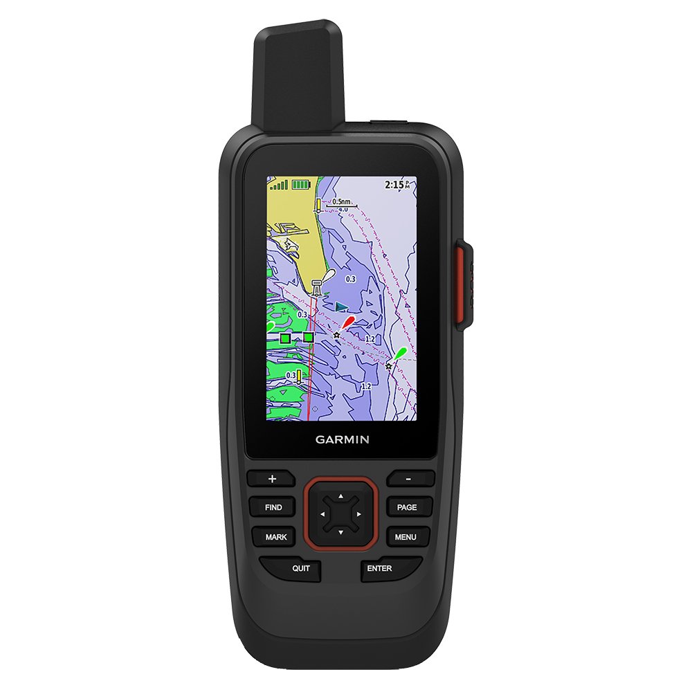
Garmin GPSMAP 86sci Handheld w/inReach & BlueChart g3 Coastal Charts
Emergency marine survival kits rely on the Garmin GPSMAP 86sci marine GPS, which combines two-way inReach satellite messaging with a buoyant IPX7 chassis, streaming preloaded BlueChart g3 coastal cartography across a sunlight-readable 3-inch TFT screen at 272g.
- Buoyant IPX7 housing floats during ditching
- Two-way inReach satellite messaging triggers emergency SOS
- Preloaded BlueChart g3 charts detail coastal contours
- Rechargeable lithium-ion battery runs up to 35 hours
- NMEA 0183 compatibility streams remote plotter data
Products are almost sold out
available only:
12In Stock
Description
The Garmin GPSMAP 86sci is the kind of handheld marine GPS that belongs in a ditch bag, tender, kayak, or cockpit pocket rather than bolted to the helm. It combines preloaded BlueChart g3 coastal charts with inReach satellite communication, so it can serve as portable navigation and a communication backup when the fixed electronics are out of reach.
The 3-inch transflective screen is small but built for outdoor use, and the front keypad is easier to operate than a phone when hands are wet. It floats, carries an IPX7 rating, and runs up to 35 hours in 10-minute tracking mode. GPS, GLONASS, Galileo, QZSS, WAAS, EGNOS, and MSAS support help with navigation. It can stream data from compatible boat plotters, but it is not a sonar display or a replacement for a full-size helm MFD.
Key Features
- Handheld GPS with inReach satellite communication – Gives the crew portable navigation and satellite messaging capability.
- BlueChart g3 coastal charts preloaded – Provides chart coverage for supported coastal waters.
- 3-inch transflective color screen – Remains practical outdoors without the power draw of a large display.
- Up to 35 hours in 10-minute tracking mode – Supports extended portable use between charges.
- Buoyant IPX7 chassis – Floats if dropped overboard and handles temporary immersion.
Who Is This For?
This marine handheld GPS communicator suits dinghies, kayaks, small utility boats, emergency ditch bags, and offshore crews. It is not a fishfinder, radar display, or replacement for a full-size chartplotter at the helm.
Compatibility
Confirmed compatibility includes NMEA 0183, WiFi, Bluetooth, ANT+, inReach satellite communication, compatible Garmin boat plotters, Garmin marine instruments, and Garmin autopilots. The supplied information does not identify NMEA 2000, radar, sonar, or third-party satellite compatibility. No named incompatible system was provided.
Technical Specifications
- Brand: Garmin
- Model: GPSMAP 86sci, 010-02088-02
- Display: 3-inch transflective color TFT
- Resolution: 240 x 400 pixels
- Charts: BlueChart g3 coastal charts preloaded
- Battery: Rechargeable lithium-ion; up to 35 hours in 10-minute tracking mode
- Connectivity: NMEA 0183, Micro-USB, WiFi, Bluetooth, ANT+, inReach
- Water rating: IPX7; floats
- Weight: 272g
- Warranty: 1 year
Warranty & Support
Garmin provides a 1-year standard warranty. The supplied specifications do not state exclusions or service procedures.
The GPSMAP 86sci is the better choice than a basic handheld GPS when satellite communication and coastal charts matter. The trade-off is screen size: it is built for portable backup navigation, not for running a full helm. Keep it in the ditch bag, on the tender, or close by when leaving the main boat.
| Brand | Garmin |
| Model Name | GPSMAP 86sci |
| Part Number/SKU | 010-02088-02 |
| Technology Category | Marine Handheld w/ Satellite Communication |
| Display Size & Type | 3" Transflective Color TFT |
| Resolution | 240 x 400 pixels |
| Brightness | N/A (Sunlight-readable) |
| Processor/Engine | Garmin High-Sensitivity Receiver |
| Operating System | Garmin Handheld OS |
| Sonar Compatibility | N/A (Can stream data from compatible boat plotters) |
| Mapping/Charts | Preloaded BlueChart g3 Coastal Charts |
| NMEA Interface | NMEA 0183 Compatible |
| Networking Ports | Micro-USB |
| Wireless | Wi-Fi, Bluetooth, ANT+, inReach Satellite |
| Voltage Input | Internal Rechargeable Lithium-ion |
| Power Draw | Battery Life: Up to 35 hours (10 min tracking) |
| Waterproofing | IPX7 (Floats) |
| Physical Dimensions | 6.75 x 17.8 x 4.4 cm |
| Cut-out Dimensions | N/A |
| Weight | 272 g |
| Country of Origin | Made in Taiwan |
| Standard Warranty | 1 Year |
You must be logged in to post a review.







Reviews
There are no reviews yet.